Price: $63.95
(as of Nov 20, 2025 20:31:53 UTC – Details)

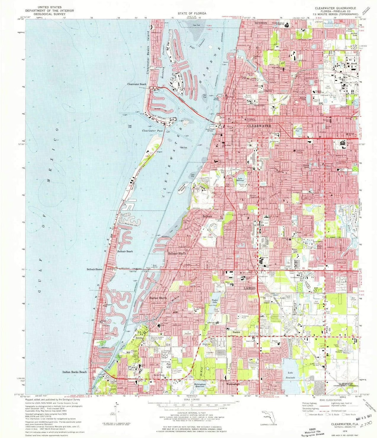
USGS topographic map of Clearwater, Florida, dated 1974, updated 1976.
Includes geographic coordinates (latitude and longitude), lines of elevation, bodies of water, roads, and more. This topo quad is suitable for recreational, outdoor uses, office applications, or wall map framing.
Printed on-demand by YellowMaps on the print material of your choice.
Shipping rolled from Minneapolis, MN, United States.
Product Number: USGS-5623034
Map Size: 26.9 inches high x 23 inches wide
Map Scale: 1:24000
Map Type: POD USGS Topographic Map
Map Series: HTMC
Map Version: Historical
Cell ID: 9085
Scan ID: 345540
Imprint Year: 1976
Woodland Tint: Yes
Aerial Photo Year: 1971
Field Check Year: 1974
Datum: NAD27
Map Projection: Transverse Mercator
Map published by United States Geological Survey
Map Language: English
Scanner Resolution: 600 dpi
Map Cell Name: Clearwater
Grid size: 7.5 X 7.5 Minute
Date on map: 1974
Geographical region: Florida, United States
Northern map edge Latitude: 28°
Southern map edge Latitude: 27.875°
Western map edge Longitude: -82.875°
Eastern map edge Longitude: -82.75°
Surrounding map sheets (copy & paste the Product No. in the search bar):
North: USGS-5623660,USGS-5623664,USGS-5623656,USGS-5623654,USGS-5620788
East: USGS-5627720,USGS-5627718,USGS-5627712,USGS-5627716,USGS-5620962
South: USGS-5627920,USGS-5958065,USGS-5627916,USGS-5627918,USGS-5958061
West:
Printed on Polypropylene (plastic)
USGS topographic map of Clearwater, FL, at 1:24000 scale. Heavier material. Waterproof. Tear-resistant. Foldable. Perfect for the outdoors.
Cities, towns, villages: Anona,Clearwater Beach,Ulmerton,Ridgecrest,Habor Bluffs,Belleair,Belleair Bluffs,Indian Rocks Beach,Walsingham,Belleair Beach,Harbor Bluffs,Clearwater,Largo,Belleair Shores,Baskin
Islands: Lone Palm Island (historical),Sand Key,Broken Island,Belleview Island,Grassy Island (historical)
Parks and forests: Indian Rocks Beach Access Park,Allen’s Creek Park,Belle Isle Park and Strip,Ridgecrest Park,Taylor Park,6th Street Beach Access Park,Skycrest Park,Lake Lucille Park,Ridgecrest Park,Crossman Park,McKay Playfield,Magnolia Park,Clearwater Beach Family Aquatic Center,Harborview Center,Belleair Boat Ramp Park,1st Street Boardwalk,Wright Park,Belmont Park,Bayside Park,Wildwood Park,Ulmer Park,Magnolia Park,David Martin Soccer Field,Norton Park,Mandalay Park